
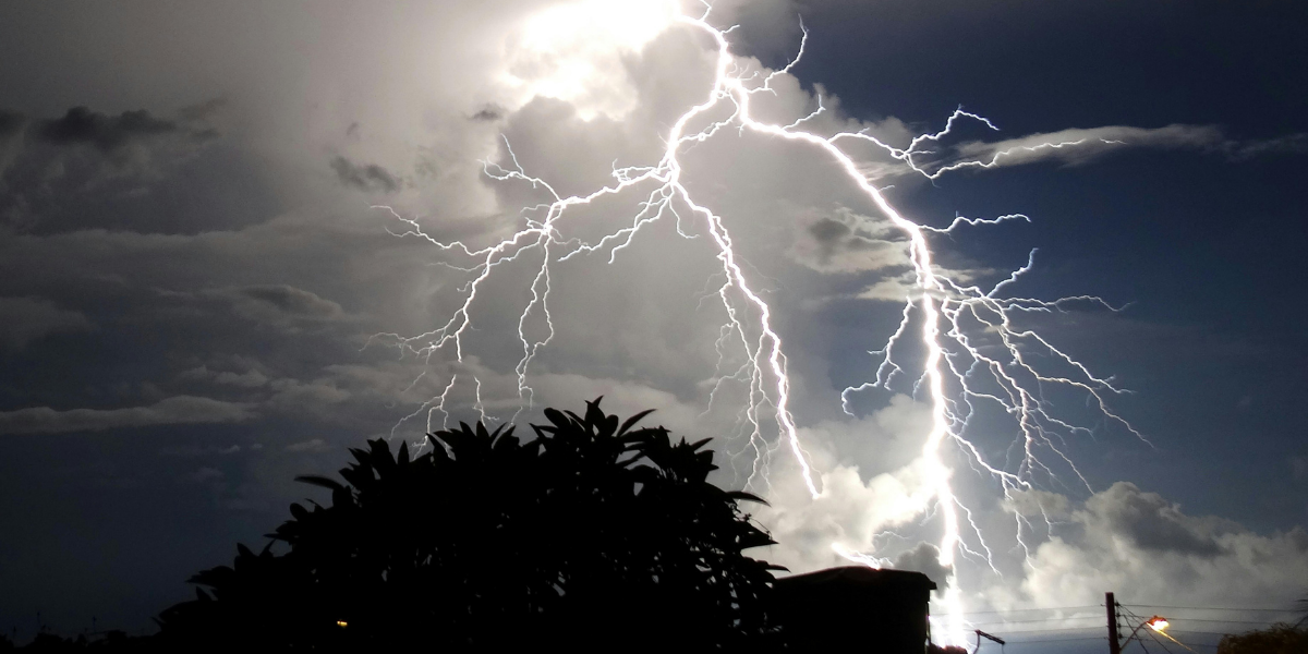
On February 15, 2026, Los Angeles experienced a brief respite from the usual winter chill, but that calm was soon interrupted by the arrival of a powerful Pacific storm system expected to sweep into the region on February 16. The storm, which is being described as a “Pacific Punch” due to its intensity, is set to bring heavy rain, strong winds, and thunderstorms to the Los Angeles Basin. This significant weather event is expected to last several days and has the potential to disrupt daily activities across the region.
What Happened Today in Los Angeles Weather
The weather in Los Angeles on Sunday, February 15, saw mild conditions, with temperatures hovering around 64°F in downtown. It was a brief window of calm before a shift in weather patterns. Meteorologists are predicting that the storm will bring rainfall, gusty winds, and the possibility of thunderstorms starting Monday, February 16, with the potential to last well into midweek. The storm will affect both coastal and inland communities, with the heaviest precipitation expected in the Los Angeles area.
Why This Matters for Los Angeles Residents
The forecasted storm brings several potential impacts to Los Angeles and the surrounding areas:
- Rainfall‑Driven Impacts
The heavy rain from the storm could lead to local flooding, especially in low-lying areas and regions prone to poor drainage. Drivers and commuters should expect possible delays and challenging road conditions due to reduced visibility and slick streets. School transportation may also be affected by the rain. - Wind and Outdoor Event Considerations
Strong south‑southeast winds accompanying the storm may impact outdoor activities, particularly those in the entertainment and event sectors. These gusts could also increase the risk of falling tree branches and debris, creating hazards for pedestrians and outdoor gatherings. - Safety and Preparedness
Local officials are urging residents to prepare for the storm by securing outdoor objects, ensuring storm drains are clear, and staying up-to-date with weather alerts. As thunderstorms may accompany the rain, it’s important to be prepared for rapidly changing conditions. - Transportation and Travel
Travel disruptions are expected, especially on roads and at airports. Heavy rain and wind could lead to flight delays at Los Angeles International Airport (LAX) and other regional airports. For drivers, slick roads and potential flash flooding may complicate travel, particularly in mountainous or flood-prone areas.
Context Within Los Angeles Weather Patterns
The Mediterranean climate of Southern California typically features dry summers and wet winters, with storms generally occurring between December and March. While the region is used to some rain during these months, the intensity of this specific Pacific storm system is noteworthy. The system, a part of a larger weather pattern moving eastward from the Pacific, is expected to bring not only moisture but also an active weather system with high winds and the possibility of thunderstorms.
These conditions are considered more severe than the average winter rainstorm. The term “Pacific Punch” is often used to describe storms like this, which carry a substantial amount of moisture and atmospheric energy. Given Los Angeles’ vulnerability to urban flooding and the disruption of daily life, this event has gained the attention of local emergency management teams.
What Residents Should Do
As the storm approaches, residents are advised to take several precautions:
- Secure outdoor items that could be blown away by strong winds.
- Monitor storm drains and clear debris around homes to prevent localized flooding.
- Stay tuned to local news stations and the National Weather Service for updated weather alerts.
- Plan for delays or disruptions in travel and public transportation.
Emergency preparedness experts are reminding residents that even relatively mild storms can lead to dangerous conditions, especially in areas prone to landslides, flooding, and poor road conditions.